The 3D space allows for comprehensive well tracking and visualization from any angle.
This fluid space contains not only offset wells, plans and projections, but also customizable targets, planes, lithologies and casing indicators. Working in conjunction with the 2D views and the project data tree, as well as the survey list, the 3D space is what makes HawkEye™ far and away the easiest and most powerful tool for well planning and monitoring.

HawkEye™ allows the user to customize the appearance of everything in the 3D space in an easy way.
Everything in the 3D space is customizable. The controls allow the user to make the appearance of the 3D space their own, both for personal preference, company-wide standardization or client-based parameters.
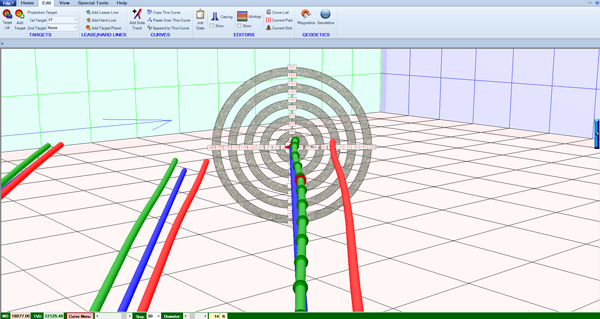
Below is an illustration of how a drilled curve can be compared against the plan and other offsets. Thickness of the curves can be exaggerated for visual purposes:
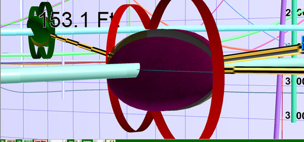
Below is an example of an ellipsoid of uncertainty on the reference curve and on the closest compare curve. The black and yellow lines are lines of closest approach. The red curves are the pedal curves, the actual outer mathematical boundary upon which industry standard separation factor is calculated: