 HawkEye™ Field: The Well-Tested Survey Program
Download HawkEye™
Click the button to download. Make sure your HASP key is plugged in. (HASP key required. Click here to order).
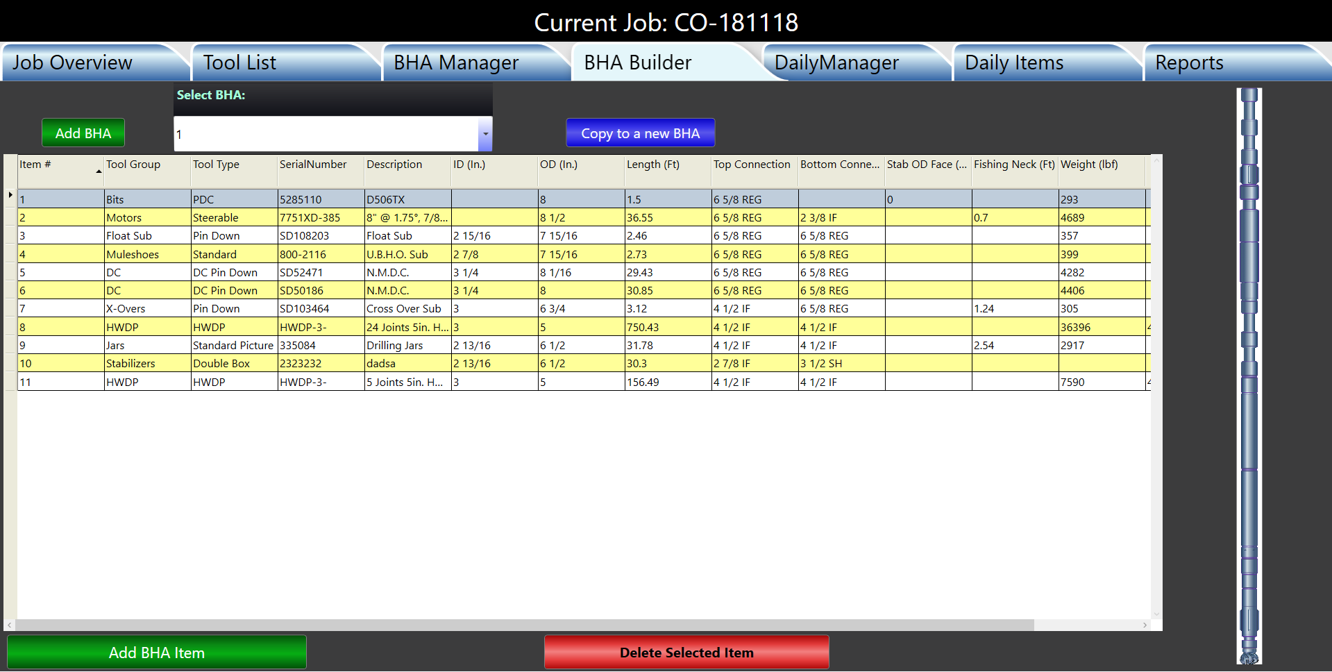
NOTE: As of June 3, 2019, HawkEye includes the Daily and BHA Reports inside the core program.
 We took WinSURV2™ and made it better:
• All Daily Activities Reports
• All BHA reports
• Costing Estimates
• Shipping Tickets
PLUS:
• Integrated surveys from HawkEye
• Single installation process
• Backwards compatibilty
HawkEye is our retail survey program.
The HawkEye™ Field package has been developed and refined over the past ten years to become a leading solution for directional drilling companies who want to track anti-collision and drill better wells. Using a combination of 3D space and error model calculations based on industry-standard models, HawkEye™ continues to provide DDs with clear and concise well tracking and analysis.
The most important thing in directional drilling is knowing where you are downhole. Location indicators that are shown in three dimensions are going to impart more information than anything 2D. But that's just the start.
The HawkEye™ Field platform excels in several major ways:
- 3D visualization of dozens of objects
- Center-to-center scans in 3D and in the reports
- Separation factor in 3D and in the reports
- Completely integrated Daily Activity and BHA (formerly a separate program called WinSURV2™)
HawkEye™ has helped thousands of directional drilling operations increase in performance by providing state of the art visualization and industry-standard error modeling to the field.
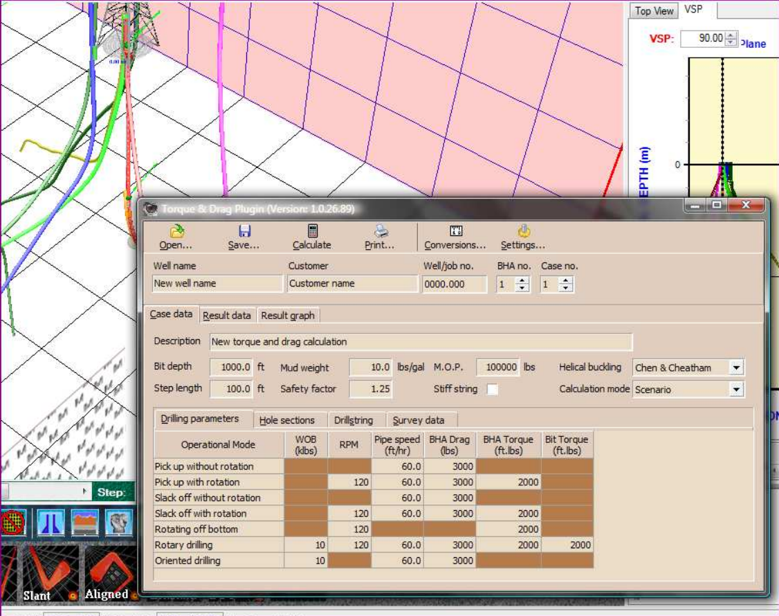
 HawkEye™ Field w/ Torque and Drag
The HawkEye™ Field package can optionally be purchased with a torque and drag program.
![]() HawkEye™ Well Planning w/Torque and Drag
HawkEye™ Well Planning w/Torque and Drag
The difference between Field and Well Planning versions:
PRINTING PLOTS: The difference between the Field Version and Well Planning Version of HawkEyeTM with plotting is that only in the Well Planning Version will the larger wall plot sizes be available for printing and exporting. Only the smaller paper sizes are available in the Field version since it is assumed that users of the Field Version will not need a plot printout larger than A3.
EDITING PROJECTIONS: Although both versions have the same arsenal of projections which can be appended end to end, only in the Well Planning version can a projection be edited at any segment and have the whole plan recalculate.
In other words, in the Field Version, only the last appended projection can be edited, so that in order to edit a part further up the curve, the user must delete all appended parts of the curve made subsequent to that higher up part before editing it. In Well Planning, the proposal is “poseable,” a model with hundreds of points of articulation.
Note: The Well Planning version contains the torque and drag module.